Larapinta Trail - Day 2 - Wallaby Gap to Arenge Bluff
Day 2 - from the designated campsite of Wallaby Gap to my proposed (non-designated) campsite near Arenge View was a distance of approx 24km.

Me on Day 2 being a much happier camper!
I first had to finish off the second half of Section 1, from Wallaby Gap to Simpsons Gap, at 11.8km. When I hike in the Top End, but more off track, this would be a full days walking in itself! Yet here I was, aiming to smash out a full days walking before 10am!
I left camp much earlier than the previous day. On Day 1 I didn’t manage to actually start walking until just after 9am, which was nearly the end of me!
So, for day 2, I made an effort to leave camp early, packing my tent up before dawn. This was the only sunrise I didn’t shoot along the entire hike - I was just so focused on the huge distance I had to cover, getting my pack positioned more comfortably and not feeling as crap as I had done on day 1! I left Wallaby gap at around 6:45am, just on dawn.
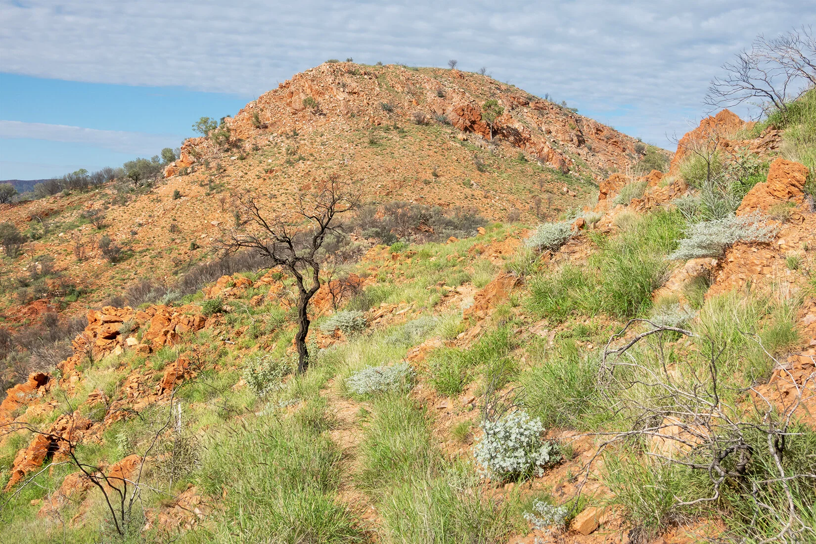
The morning was unusually cloudy and therefore thankfully cooler and shadier! The terrain was nice and flat, until I approached Hat Hill saddle. I had been walking for 2 hours as I reached the saddle, and on the small ascent I checked for phone service (I had it with Telstra), as I wasn’t sure I’d get it again that day with no more ascents. The light was just coming through the clouds, so it was a great photo and snack stop too!

Hat Hill Saddle looking lush
I was much happier with my progress - I had covered 8.7km in around 2 hours. I was finding I needed a break from wearing my pack every 40 minutes or so, which I was happy with. It basically meant I had a 5-10 minute break every 3 or 4 km.
It was another easy kilometre or so in to Simpsons Gap, where I stopped to ill up on food, water and a toilet break! I arrived at Simpson’s Gap at 9:40am… 3 hours to do 10.8km, with a couple of breaks. I was happy with my progress! My bag felt much more comfortable, and luckily it would only improve from there. It’s an Osprey women’s 55l pack, which always takes a couple of days for me to get it sitting in the right spot (I have no idea why, but i naturally don’t want to fit the bag correctly and it takes a day or two of tweaking straps and distributing weight to get it right!

This was taken at dawn, on my trip back to Simpsons Gap after the hike.
Leaving Simpsons Gap marks the start of Section 2, which in total is 26.2km. My plan was to walk around another 10km or so, which would have bought my arrival in to camp to around 3pm if I kept the same pace. The terrain again is fairly flat by Larapinta standards! My plan was to collect water and eat my main meal at Bond Gap, before walking another kilometre or so, to find a random campsite with a good view back to Arenge Bluff.
I left Simpsons Gap at around 10:30am, and could already feel the heat of the day. My pace had definitely slowed, and I probably made it to Bond Gap by around 1:30pm. In my heat exhausted state I didn’t really take any photos during this afternoon (the first two days on the trail were around 36 degrees Celsius). I was just chugging the hydra-lyte and trying to stay cool!

Lunch break at Bond Gap
I took a good 3 hour break in the shade of Bond Gap. This was my first ever water carry, and I’ve never camped away from a water source before. So I decided to eat my evening meal here, so I could conserve water later on that night.
My maps suggested it was only going to be 1-2km until I finished for the day anyway, so I had plenty of time to relax.
For some reason in my tired and heat confused state, I misread the Larapinta Trail map information (not the map itself, the descriptive wording alongside the map). The map showed me I’d have around 1.5km to walk, until a make shift suitable campsite - a flat clearing area with a view to Arenge Bluff. However, the wording talked about a camp with a good view, 4km away. (Which, looking back now, maybe the description was talking about Mulga Camp?! I’m still confused).
Upon leaving Bond Gap, I did see a perfectly flat campground (which had a rock “wall” built around it, so was obviously the campsite referred to on the Larapinta map). However, I’d only been walking for ten minutes since Bond Gap, and I had decided the view back to Arenge Bluff wasn’t that great for photography - there were too many trees in the way. I decided to push on for the actual “Arenge View” which I’d presumed must have been the 4km away.

Time was pushing on, and I never reached this mysterious Arenge View - which wasn’t labeled on my map, but I’d read about it in the “Larapinta Trail” book my John and Monica Chapman (a very helpful planning guide, by the way!). I wish I had photographed or photocopied that page so I knew what they were referring to!
In the end, I was getting tired (I’d been walking since 6:45am don’t forget!). It seemed like I was getting way too far away from Arenge Bluff for there to be any sort of decent photographic opportunity at this “Arenge View” location….. So I decided to just find a flat bit of ground to camp as soon as there was a clear view.
I didn’t get in to my “camp” until after 5pm - which for me and photography time, is cutting it fine. I need time to put up the tent and set up camp as well as shoot that final hour of light (at least!).

Late afternoon light on Arenge Bluff

Me waiting for the sunset light which didn’t happen! Haha, photography life, hey
I camped up above a dry creek bed. I could hear a lot of cows which must have been down in the creek. I put the tent up and got everything organised so I could shoot sunset light on the bluff. The flies were insane in this spot, even though they hadn’t bothered me the entire time I had been in Central Australia (pushing on 2 weeks by that point). I blame the cows!
After sunset, I had planned on having a quick snack before bed, but any plans of that were very quickly ruined by the insane mosquitoes. As soon as photo time was finished, I dived in to the tent for a bit of relief! No dinner, and an early night after a good 11 hours of walking! (well, with a 3 hour break…..)

I didn’t get the nice light right on sunset thanks to a bit of cloud behind me!

The view from my makeshift camp